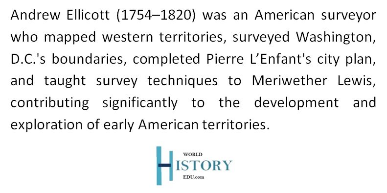
American Land Surveyor Andrew Ellicott
Andrew Ellicott (1754–1820) was a renowned American land surveyor, mathematician, and astronomer whose precise survey work helped shape the early United States. Known for his meticulous approach, Ellicott played a pivotal role in defining boundaries, planning cities, and mentoring explorers, leaving an indelible mark on the development of the nation. His career spanned significant historical events, including the American Revolutionary War, the creation of the District of Columbia, and the early territorial expansion of the United States.

Andrew Ellicott (1754–1820) was an American surveyor, mathematician, and scientist known for defining territorial boundaries, planning cities, and mentoring explorers, shaping the early United States’ physical and cultural development. Image: Portrait of Ellicott by American painter Jacob Eichholtz.
Early Life and Education
Andrew Ellicott was born on January 24, 1754, in Buckingham Township, Pennsylvania, the eldest of nine children in a Quaker family. Despite their modest circumstances, Ellicott demonstrated an early aptitude for mechanics and mathematics. His education at a local Quaker school introduced him to Robert Patterson, a teacher who later became a professor at the University of Pennsylvania and influenced Ellicott’s intellectual growth.
In 1770, Ellicott’s family moved to Maryland, where his father and uncles established Ellicott’s Mills (now Ellicott City). The family’s milling business became a vital economic hub in the region. In 1775, Ellicott married Sarah Brown, with whom he had ten children. Although raised in a pacifist Quaker tradition, Ellicott enlisted in the Maryland militia during the Revolutionary War, earning the rank of major. His military service reflected his commitment to the American cause and earned him an honorific title he used throughout his life.
Surveying Achievements
After the Revolutionary War, Ellicott embarked on a career as a surveyor. His precision and innovation established him as one of the foremost surveyors of his time, and his contributions were critical to the development of early American infrastructure and territorial boundaries.
Mason-Dixon Line Extension
In 1784, Ellicott joined a commission tasked with extending the Mason-Dixon Line, originally surveyed in the 1760s to resolve border disputes between Pennsylvania, Delaware, and Maryland. This project, which had been interrupted during the Revolutionary War, was essential for clarifying state boundaries. Working alongside esteemed scientists like David Rittenhouse and Bishop James Madison, Ellicott gained valuable experience and established connections with the American Philosophical Society, an organization of leading intellectuals.
Pennsylvania Border and the Northwest Territory
In 1786, Ellicott was commissioned to survey Pennsylvania’s western boundary, which became known as the Ellicott Line. This survey defined the border between Pennsylvania and the Ohio Country and became a key reference point for the Northwest Territory’s future surveys. Through this work, Ellicott solidified his reputation for precision and accuracy, earning the trust of political leaders and scientific institutions.
Surveying the District of Columbia
One of Ellicott’s most notable achievements was his role in surveying the boundaries of the District of Columbia in 1791. At the request of President George Washington, Ellicott worked under the supervision of federal commissioners to delineate the borders of the federal Territory of Columbia, which later became the capital city of Washington, D.C.
Ellicott collaborated with the free African-American astronomer Benjamin Banneker and his brothers Joseph and Benjamin to place 40 boundary stones marking the district’s limits. These stones, many of which still exist, were strategically placed approximately one mile apart to form a 100-square-mile federal district.
Ellicott also played a critical role in revising Pierre Charles L’Enfant’s city plan for Washington, D.C. When L’Enfant refused to provide his original plans for engraving and distribution, Ellicott redrew the map, straightening avenues, adjusting plazas, and simplifying the design. His 1792 revision became the foundational blueprint for the city, shaping its future development. Despite the political tensions surrounding the project, Ellicott’s work ensured the successful establishment of the nation’s capital.

Image: Benjamin Banneker
Contributions to the Erie Triangle
In 1794, Ellicott was commissioned to plan the city of Erie, Pennsylvania, providing the state with access to the Great Lakes and enhancing its trade potential. During this project, he also conducted a topographical survey of the Niagara River, producing the first detailed map of Niagara Falls. These efforts demonstrated his geographic expertise and underscored his role in expanding and integrating the nation’s infrastructure.
Southern Boundary Survey
One of Ellicott’s most challenging assignments came in 1796 when he was appointed to survey the southern boundary between U.S. and Spanish territories, as defined by the Treaty of San Lorenzo (1795). This survey established Ellicott’s Line, which remains the boundary between Alabama and Florida.
Over four years, Ellicott and his team worked under difficult conditions, including hostile terrain, political tensions, and limited resources. His detailed maps and journal entries from this expedition became invaluable historical records. Ellicott’s diplomatic skills were also evident during the project, as he navigated delicate negotiations with Spanish officials while ensuring the survey’s completion.
Scientific Contributions and Mentorship
Ellicott’s expertise extended beyond surveying; he was also a skilled mathematician and astronomer. His scientific knowledge earned him membership in the American Philosophical Society and brought him into contact with luminaries such as Benjamin Franklin.
In 1803, President Thomas Jefferson enlisted Ellicott to mentor Meriwether Lewis, one of the leaders of the Lewis and Clark Expedition. Ellicott trained Lewis in advanced surveying techniques, provided recommendations for equipment, and offered guidance on navigation and mapmaking. His mentorship contributed significantly to the success of the expedition, which charted vast territories in the western United States.
Challenges and Controversies
Ellicott’s career was not without difficulties. He frequently clashed with political authorities and faced financial hardships. After completing the southern boundary survey, he accused high-ranking officials, including General James Wilkinson, of treason for accepting bribes from Spain. While his accusations were valid, they led to conflicts with powerful individuals and delayed his payment for the survey.
In 1809, Ellicott was dismissed from his role as Secretary of the Pennsylvania Land Office due to political differences, particularly with Wilkinson. These challenges highlighted the intersection of science, politics, and personal integrity in Ellicott’s career.
Later Years and Legacy
In 1813, Ellicott accepted a professorship in mathematics at the United States Military Academy at West Point, where he educated future military leaders until his death in 1820. His final survey work involved verifying the U.S.-Canada boundary as part of the Treaty of Ghent.
Ellicott’s influence extended beyond his lifetime. His precise surveys and maps provided the framework for America’s territorial expansion and urban development. His contributions to science and education solidified his reputation as a pioneer in his field.

Image: Ellicott’s House, located at 123 North Prince Street in Lancaster, Pennsylvania, is recognized on the National Register of Historic Places.
Commemorations and Memorials
Andrew Ellicott’s legacy is honored in several ways:
- Andrew Ellicott Park: Located at the original western boundary of the District of Columbia, this park commemorates his work in defining the nation’s capital.
- Ellicott City, Maryland: The town founded by his family bears his name, reflecting the lasting impact of the Ellicott family on the region’s development.
- Street Names and Landmarks: Streets and neighborhoods in Washington, D.C., and other locations carry his name, acknowledging his contributions to America’s infrastructure.
- Historic Sites: Ellicott’s work is celebrated in various historical sites, including boundary markers and survey lines, which serve as enduring reminders of his precision and dedication.
Conclusion
Andrew Ellicott’s life and work represent a critical chapter in the history of the United States. Through his meticulous surveys, innovative mapping techniques, and dedication to public service, he helped define the physical and cultural boundaries of a young nation. Despite political challenges and personal sacrifices, his contributions to science, urban planning, and territorial expansion left a legacy that continues to shape America’s landscape.
Frequently Asked Questions
What was Andrew Ellicott’s early background and education?
Born into a Quaker family in Pennsylvania, Ellicott showed an early aptitude for mechanics and mathematics. He attended a local Quaker school where Robert Patterson, a future University of Pennsylvania professor, influenced his education.
What role did Ellicott play in the Mason-Dixon Line extension?
In 1784, Ellicott was part of the commission that extended the Mason-Dixon Line to resolve border disputes between Pennsylvania, Delaware, and Maryland, working alongside prominent scientists like David Rittenhouse.
What was the “Ellicott Line,” and why was it significant?
The “Ellicott Line,” surveyed in 1786, marked Pennsylvania’s western boundary. It became a principal reference for surveys in the Northwest Territory, highlighting Ellicott’s precision and reputation.
What were Ellicott’s contributions to the District of Columbia?
Ellicott surveyed the boundaries of the federal Territory of Columbia and revised Pierre Charles L’Enfant’s city plan, creating a foundational blueprint for Washington, D.C., including straightened avenues and simplified designs.
How did Ellicott contribute to Pennsylvania’s access to the Great Lakes?
In 1794, Ellicott planned the city of Erie, Pennsylvania, securing the state’s access to the Great Lakes and conducting the first detailed survey of the Niagara River, including Niagara Falls.
What challenges did Ellicott face during the southern boundary survey?
From 1796 to 1800, Ellicott surveyed the boundary between U.S. and Spanish territories (Alabama and Florida) under harsh conditions, producing invaluable maps. However, political conflicts delayed his payment.
What was Ellicott’s role in training Meriwether Lewis?
At Thomas Jefferson’s request in 1803, Ellicott mentored Lewis, teaching surveying techniques and advising on equipment for the Lewis and Clark Expedition, contributing to its success.
What controversies marked Ellicott’s career?
Ellicott accused officials like General James Wilkinson of treason for accepting Spanish bribes, leading to political conflicts and financial difficulties, including dismissal from the Pennsylvania Land Office in 1809.
What role did Ellicott have at West Point?
In 1813, Ellicott became a professor of mathematics at the United States Military Academy at West Point, educating future military leaders until his death in 1820.
How is Andrew Ellicott commemorated today?
Ellicott is honored through landmarks like Andrew Ellicott Park, the town of Ellicott City, and street names in Washington, D.C., reflecting his lasting impact on America’s development.