Ancient City of Ugarit
Ugarit, an ancient port city located in northern Syria approximately 10 kilometers north of modern-day Latakia, was a vital cultural and commercial hub during the Bronze Age. Known by its Ugaritic name ‘ʾUgarītu’ (𐎜𐎂𐎗𐎚), this city played a significant role in the ancient Near East’s political and economic networks. Discovered accidentally in 1928 along with the Ugaritic texts, the site of Ugarit, often referred to as Ras Shamra, has provided invaluable insights into the region’s history, culture, and interactions with other civilizations.
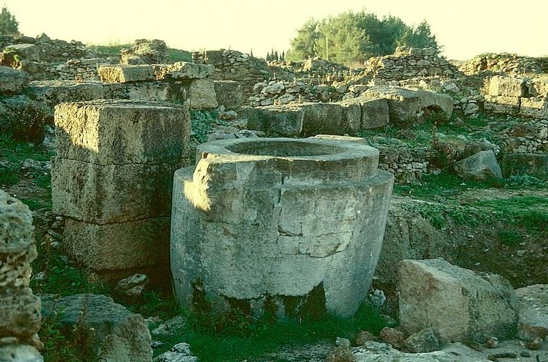
Remains of Ugarit.
Neolithic and Chalcolithic Periods
The site of Ugarit was first settled in the Neolithic period, with evidence of occupation dating back to the 8th millennium BCE. Archaeological findings suggest continuous habitation through the Chalcolithic and Bronze Ages. However, much of the knowledge about Ugarit’s early history remains limited, as excavations have predominantly focused on its Late Bronze Age levels.
Middle Bronze Age
During the Middle Bronze Age, Ugarit became associated with the powerful kingdom of Yamhad, centered in Aleppo. This period saw the city’s growing importance as a regional player.
Egyptian artifacts such as carnelian beads inscribed with the name of Pharaoh Senusret I and other items linked to Senusret III and Amenemhat III reveal Ugarit’s early connections with the Middle Kingdom of Egypt. The Mari archives also reference Ugarit, indicating its significance in regional politics and trade.
Late Bronze Age: The Golden Age
The Late Bronze Age marked the zenith of Ugarit’s prosperity. Between 1500 BCE and 1200 BCE, the city flourished as a trade-based coastal kingdom, controlling an area roughly equivalent to the modern Latakia Governorate. Ugarit’s population during this period is estimated at 7,000 to 8,000 people, with its territory spanning approximately 2,000 square kilometers.
Political Alliances and Dependencies
Ugarit maintained diplomatic ties with major powers such as Egypt, the Hittite Empire, and Cyprus (then known as Alashiya). Letters found in the Amarna archives underscore the city’s diplomatic relations, particularly during the reigns of kings Ammittamru I and Niqmaddu II. Initially a vassal of the Hittite Empire, Ugarit’s strategic location allowed it to mediate between the eastern Mediterranean and the Levant.

At its peak (1500–1200 BC), Ugarit was a major trade hub, controlling a coastal kingdom of about 2,000 km² with a population of 7,000–8,000. Image: Ruins of the Royal Place of Ugarit.
Economic Prosperity
Ugarit’s location on the Mediterranean coast facilitated its emergence as a thriving trade hub. The city’s ports connected it to Egypt, the Aegean (notably Crete), and other regions across the eastern Mediterranean. Archaeological finds, including Mycenaean and Cypriot pottery, confirm extensive trade networks.
Key exports included:
- Agricultural products: Grains and wine from Ugarit’s fertile hinterlands.
- Metals and luxury goods: Copper, ivory, and fine textiles.
Ugarit also served as a conduit for cultural exchange, evident in the diffusion of art, technology, and ideas across the region.
Cultural Achievements
One of Ugarit’s most remarkable contributions to history is its development of the Ugaritic alphabet, one of the earliest known alphabets, dating back to around 1400 BCE. This cuneiform script comprised 30 characters and was used for administrative, diplomatic, and literary purposes.
Ugarit’s libraries, uncovered during excavations, contained thousands of cuneiform tablets. These texts include mythological epics such as the Baal Cycle, which describes the storm god Baal’s conflicts with Yam (the sea) and Mot (death). Other works, like the Legend of Keret and the Tale of Aqhat, offer glimpses into Ugaritic religion and social values. The city’s pantheon included deities such as El, Baal, and Anat, reflecting a polytheistic belief system with parallels to other Semitic traditions.

Urban Structure and Archaeological Discoveries
The City Layout
Covering an area of approximately 28 hectares, Ugarit was surrounded by fortified walls. Key features included:
- The Royal Palace: A sprawling complex of over 6,500 square meters, featuring administrative offices, archives, and royal residences.
- Temples: The Acropolis housed the Temples of Baal and Dagan, centers of religious worship and monumental architecture.
- Residential Areas: Dense neighborhoods with houses arranged around courtyards.
The Royal Palace Archives
Excavations revealed that the Royal Palace housed vast archives containing administrative documents, correspondence, and literary texts. These records illuminate the city’s governance, economy, and foreign relations.

Destruction and the Bronze Age Collapse
Ugarit met its demise around 1190 BCE, during the tumultuous events of the Bronze Age Collapse. While the exact cause remains debated, potential factors include:
- Sea Peoples: Invasions by maritime raiders are frequently cited in contemporary texts.
- Internal Struggles: Economic decline and social upheaval may have contributed.
- Environmental Factors: Widespread food shortages and plant diseases likely exacerbated the crisis.
During the reign of King Ammurapi, Ugarit faced mounting threats. Correspondence from this period reveals the desperate pleas for assistance sent to allies like Egypt and the Hittites. Despite these efforts, Ugarit was sacked, and its population dispersed. The city was abandoned, and its location forgotten until its rediscovery in the 20th century.
Discovery in 1928
Ugarit’s rediscovery began in 1928 when a local farmer uncovered an ancient tomb near Ras Shamra. Subsequent excavations, led by French archaeologist Claude Schaeffer, unearthed the city’s ruins and its wealth of artifacts.
Archaeological Significance
The site’s well-preserved remains have provided invaluable insights into the Late Bronze Age. Key discoveries include:
- Libraries: Archives containing administrative, legal, and literary texts.
- Artifacts: Mycenaean pottery, ivory carvings, and tools.
- Architecture: The layout of the Royal Palace, temples, and residential areas.
Legacy of Ugarit
The Ugaritic alphabet significantly influenced later writing systems, including the Phoenician and Greek alphabets. Ugaritic literature offers a window into the religious and cultural practices of the ancient Near East.
Ugarit’s destruction serves as a case study for understanding the broader collapse of Bronze Age civilizations. Its archives detail the interconnectedness of ancient societies and the vulnerabilities that led to their decline.
The site of Ugarit remains a testament to the ingenuity and resilience of ancient peoples. Ongoing excavations continue to shed light on this remarkable civilization, ensuring its legacy endures.
Frequently Asked Questions

The exact location of Ugarit, as shown (in red) on a map of Syria.
When was Ugarit first settled?
The site was occupied from the Neolithic period, around the 8th millennium BC, continuing through the Chalcolithic and Bronze Ages.
What were Ugarit’s significant trade and diplomatic connections?
Ugarit traded with Egypt, Cyprus, the Aegean, the Hittites, and cities in the Levant. It maintained diplomatic ties with Egypt and the Hittites.
What caused the destruction of Ugarit?
Ugarit was destroyed around 1190 BC during the Bronze Age Collapse, possibly due to the Sea Peoples or internal struggles.
What is the significance of the Ugaritic alphabet?
Developed around 1400 BC, it was one of the earliest alphabets, influencing the Phoenician script and indirectly modern alphabets.
What were the key archaeological discoveries at Ugarit?
Findings include the Royal Palace, temples of Baal and Dagan, and numerous cuneiform tablets detailing trade, law, and mythological texts.